2003 - Page 2
When A Mine Closes
- Continued -
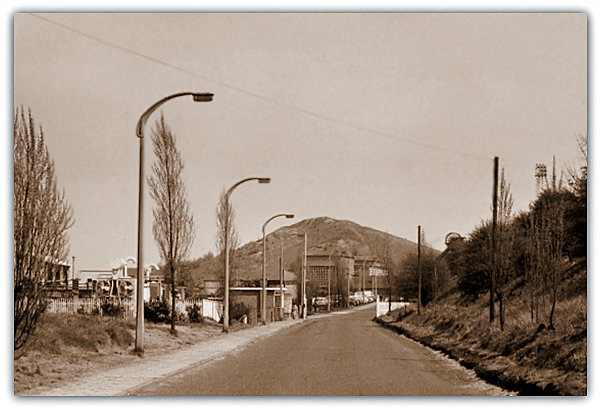 Problems associated with a mine closing prematurely could be that the dirt tip for the mine may not have been finished off to the proposed contours etc agreed by the County Council. The tips are controlled by the Town and Country Planning (Minerals) Act 1981. Many old tips have been sold to the local authority for a nominal peppercorn fee of £1 and various landscaping schemes have been carried out. Mansfield colliery tip (Rice Hill), the last remaining McLane conical tip in the region, ‘supposedly preserved’ after local feeling prevailed, was partially demolished in 2003. A few other tips have also been dug out and the material re-washed to extract the small discarded coal (e.g. Pleasley and Creswell for example). Some tips have been moved to allow opencast mining of shallow seams to take place. The area has then been landscaped. Problems associated with a mine closing prematurely could be that the dirt tip for the mine may not have been finished off to the proposed contours etc agreed by the County Council. The tips are controlled by the Town and Country Planning (Minerals) Act 1981. Many old tips have been sold to the local authority for a nominal peppercorn fee of £1 and various landscaping schemes have been carried out. Mansfield colliery tip (Rice Hill), the last remaining McLane conical tip in the region, ‘supposedly preserved’ after local feeling prevailed, was partially demolished in 2003. A few other tips have also been dug out and the material re-washed to extract the small discarded coal (e.g. Pleasley and Creswell for example). Some tips have been moved to allow opencast mining of shallow seams to take place. The area has then been landscaped.
When A Mine Is Abandoned
Note: When a mine is abandoned or a working is discontinued it is the duty of the owner and any other person interested in the minerals at the mine to make sure that the entrance to every shaft and outlet to be surrounded by a structure of a permanent character to prevent accidents. Any shaft or outlet which is not kept surrounded by a structure as required by this section shall be deemed to be a nuisance within the meaning of section 91 of the Public Health Act, 1875.
Prior to the NCB issuing a booklet in the 1980s called ‘The Treatment of Disused Mine shafts and Adits’ many abandoned shafts were just fenced round or had the shaft top covered over and the shaft left open. Some shafts were filled with any old rubbish, usually dirt tip refuse or slurry or demolished building refuse on the site. The booklet outlined various shaft treatments to be adopted. The old methods were fraught with danger and much of the material used was not suitable and slumping could occur.
Note the NCB and British Coal and the later Coal Authority are only responsible for coal shafts, any other mineral shaft is the responsibility of the relevant Council.
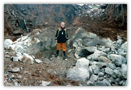 The new system dictated that that a proper survey of the shaft to be abandoned was to be made and calculations and design to be made by qualified civil engineers. Proper concrete stoppings were to be made in the pit bottom and calculated amounts made of concrete to be tipped down the shaft to cover the sump area, pit bottom areas and insets as well as fan drifts etc. Graded limestone chippings were to be tipped as a shaft-fill material between and measurements down the shaft were to be made each shift and a calculation made by the Surveyor that agreed with the pre-calculated within an agreed amount (something around 2%). Checks on any make of water, gas and ventilation amounts are also made. Each shaft top is then covered with a reinforced concrete slab covering a larger area than the size of the shaft. British Coal appointed Closed Colliery Managers to oversee the closing down procedure at abandoned mines. The photo shows the filled shaft at Ollerton prior to a concrete cap being laid over it. The new system dictated that that a proper survey of the shaft to be abandoned was to be made and calculations and design to be made by qualified civil engineers. Proper concrete stoppings were to be made in the pit bottom and calculated amounts made of concrete to be tipped down the shaft to cover the sump area, pit bottom areas and insets as well as fan drifts etc. Graded limestone chippings were to be tipped as a shaft-fill material between and measurements down the shaft were to be made each shift and a calculation made by the Surveyor that agreed with the pre-calculated within an agreed amount (something around 2%). Checks on any make of water, gas and ventilation amounts are also made. Each shaft top is then covered with a reinforced concrete slab covering a larger area than the size of the shaft. British Coal appointed Closed Colliery Managers to oversee the closing down procedure at abandoned mines. The photo shows the filled shaft at Ollerton prior to a concrete cap being laid over it.
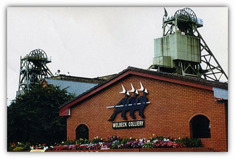
However after privatisation e.g. at Welbeck the shafts were filled with tip waste and demolished building rubble, the purchasing of limestone chippings costing money, a commodity private firms cannot deal with. No brick stoppings were built in the pit bottoms either to stop the material possibly slumping later as at the shaft fills under British Coal before.
Underground Water
A further problem can be underground water. The pits situated towards the west of the counties are relatively shallow and the main source of the mine water is usually from aquifers replenished by rainwater that flows into the old works. The mine water is usually saline and generally contains iron giving the water a red rusty colour. Coal seams contain iron pyrite as well as other compounds. Some mines although not working are kept open as pumping shafts to protect other mines in the district and as a general rule due to the dip of the strata running from west to east the Derbyshire pits have always supplied water to the Nottinghamshire pits a commodity that they did not want!
From 1986 for the first time ever Nottinghamshire water from Teversal colliery closed in 1980 flowed through to Pleasley colliery in Derbyshire in quantity, where after filling dip side old workings eventually had to be sent through the connection to Shirebrook and raised there. (In 1963 on the orders of the HMI the pumps at the Top Hard North Dips at Teversal were switched off and abandoned due to the only access to same being by the Old North Level that was in a dangerous condition for the pump man to travel daily. A small amount of nuisance water reached Pleasley stables within a fortnight but then stopped as the water source was directed via the Ricket gate to Teversal pit bottom water lodge and pumped out of the mine.)
However this water was a major concern. Shock horror! Meetings were held at top level to see if it was possible that Nottinghamshire Area would pay for the pumping. I sat in a meeting at Coleorton with 2 others from Edwinstowe to meet the Deputy Chief Mining Engineer and Surveyor and I began to wonder whether all Areas of British Coal were in the same company. The fact that Nottinghamshire Area had always paid for pumping ex Derbyshire Area water didn’t seem to come into the equation. I still don’t know which Area paid for the pumping as the answer seemed to disappear behind closed doors for the likes of me.
Pumped mine water cannot always be delivered into the nearest watercourse. The National Rivers Authority can refuse to allow a discharge unless aeration and further treatment can be carried out to prevent ochre staining or acidic water etc. or damage to aquatic life downstream (e.g. Bentinck a 10 miles (17 km) long pipe line to the River Leen and onwards to the Trent instead of into the nearby River Erewash, and Langwith water into the River Poulter). At Creswell aeration of the water was another requirement before being fed into the river passing through Creswell Crags to Welbeck Lakes, because of the influence on fish breeding etc. For certain months of the year Creswell water had to be pumped overland to the River Rother. Electronic measurement of the quantity of water pumped was implemented at Creswell as an alternative to the paddle wheel method that had a tendency to clog up giving false readings. Quantities rising up to 130m gallons a year were pumped there. (Note: Water was still being pumped there at one open shaft up to 2015 to protect the underground water reaching mines to the dip side. However with the closure of Welbeck in 2010 that had connections to Thoresby, when Thoresby closed in 2015 the pumping ceased. Pumping mine water can be very expensive indeed! Several pumping stations were spread about, however these would be abandoned as the mines that they were protecting closed. A similar aeration scheme was at Morton where water pumped from underground cascaded down a purpose made series of step slopes on the tip.
The River Trent and the Yorkshire Ouse Catchment Area Boundary passes through Hardwick Park just to the North and East of the Hall and passes into Derbyshire and through Glapwell. It also swirls down from Hardwick towards Wild Hill and Tibshelf. This is the watershed where all water flowing to the North beyond that line is classified as flowing to the sea via the River Ouse, whereas below the line to the South it is deemed to flow to the Trent. Of course money must come into it somewhere and the respective Area authority would gain. The mind boggles. When I was an Apprentice and then Assistant Surveyor at Teversal one of my tasks each year was to work out the amount of coal either side providing there was some being worked of course. It was all wrapped up with the Parish tonnages I think whereby any coal worked was apportioned to that Parish at so much a ton. There was a proportion for the Parish where the shaft was. There was also a proportion for carrying the coal through a Parish so sometimes it could get quite complicated. For example where there are Parish boundaries meeting at a common point a panel could be working along and through the 3 Parish boundaries and so the coal was worked partly in each of the Parishes and it may be carried through all 3 Parishes or even back through 2 of the Parishes by chance and raised at the shaft in another Parish. If the coal was worked in the same Parish as the shaft then the formula was easy. All coal worked in that Parish, carried through that Parish and raised in that Parish so they would get all 3 portions of the amount, a far simpler calculation. All these examples were calculated out by area and volume of coal worked allowance being made for the true dip area with the average seam section and compared to the raised and weighed figure and saleable coal. As you can see all is not plain sailing and far beyond the reasoning of the lay man.
Appointments
Stephen Timms (Lab) MP succeeded Brian Wilson (Lab) as Energy Minister in June 2003. Trade and Industry Secretary Patricia Hewitt (Lab) continued. Environment Minister Lord Whitty was approached later in the year by Paddy Tipping (Lab) MP for Sherwood, regarding the ‘medium and long term future’ of coal mining.
Clipstone Shaft Fill
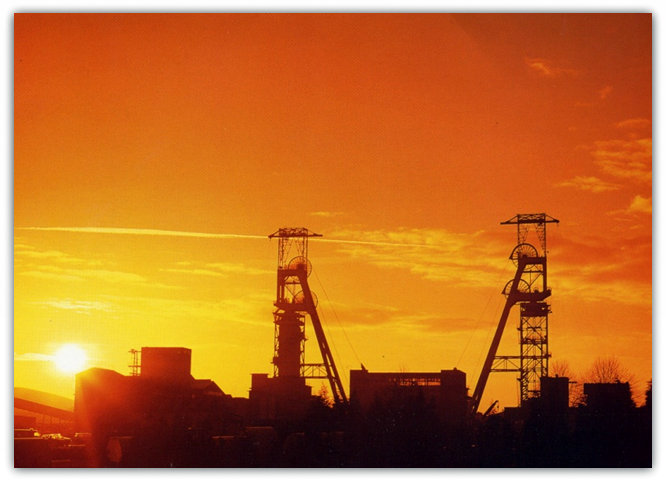
Stone filling began at the disused shafts at Clipstone colliery (Nottinghamshire) on 1st September 2003. A total of 100,000 tonnes was needed to fill the two shafts by end of September. Demolition of the canteen and pithead baths buildings on the opposite side of the road from the pit yard accessed by tunnel commenced in February 2005. The Koepe headstocks and the pithead buildings were left. Controversy still abounds in 2013 as to whether to continue to keep the historic and unusual headgears in place and there is a need to maintain them or to demolish them and create a brown-field site for future housing. The village population of Clipstone were still not clear as to which option to take.
Searching For Old Shafts
Investigation continues with a special team at the Coal Authority checking for abandoned shafts and adits particularly on proposed housing estates etc. It is the policy of the Authority that only coal shafts are to be treated. The shafts found occasionally as they collapse are located, made secure by fencing etc then filled with stone and concrete and capped off. Private firms employing Surveyors are continually examining existing abandonment plans held at the Mining Records Office.
Other sources of information for old shafts of coal and other minerals are plans made by various Surveyors over the years as well Ordnance Survey Maps (all editions, the earliest being 1830s) on scales 1:10,560 (6” to a mile), 1:10,000 (metric edition), 1:2500, 1:1,250, 1:1,056 and 1,500, 2 inches and 1 inch to one mile.
Further Ordnance Survey Maps produced for local authorities previously for the Health of Towns Act 1841 on scales 1:528 for dense built up areas and on 1:2,460 for open areas.
Another Ordnance Survey source is the Tithe Map series 1836 to 1860 on scales 13.3 and 16.7 inches to a mile and previous Enclosure Maps from the early 1800s on similar scales.
Another source is the Geological Survey Maps (all editions, earliest c1875) on 1:10,560 scale together with field slips and notebooks held by the Institute of Geological Sciences, now located at British Geological Survey, Keyworth, Nottingham. Records in the Public and County Records Offices and in the possession of local government and other public authorities, for example various Authorities, Drainage Board, British Railways (before re-privatisation), British Waterways. Maps and records in public libraries and museums. Private sources that could include title deeds in solicitors’ offices, former colliery company and owners, consulting engineers, County Archives centres, local history societies and historians, individuals with local knowledge. Technical press. Aerial photographs. The Department of the Environment and Aerial Survey Companies have private libraries from which copies of aerial photographs may be purchased.
Of course other sources that may come to light on occasion are plans kept by individuals and others found in lofts etc when a house is cleared or demolished. Of course all shaft positions on old plans should be treated with a slight suspicion, allowing for error in plotting etc and also different editions or later editions may not contain the same information, usually that information available at the time of making the map.
Part of a recreation ground near a football pitch at Riddings, Jacksdale was sealed off in October 2003 after it being reported of the discovery of 3 suspected mine shafts in September. The Coal Authority explored the site with a view to making the area safe.
Throughout the country many more old shafts would be found and treated, but how many more would need to be. They are countless but could be between 60,000 to 100,000 I would suggest, plus thousands of other non-coal shafts that are examined but not treated by the Coal Authority.
As I Remarked In My Opening Introduction
Beware Of A Small Grass Covered Hillock In A Field Corner
In the future gas may eventually be forced out of the old mines by being displaced by water. This has already been experienced near Rotherham in South Yorkshire and Arkwright village in North Derbyshire. Pumping of mine water continues daily at Woodside, and pumping at Blackwell A Winning and Morton (all in Derbyshire) occasionally to keep the water levels down.
The Coal Mining Industry Influenced For Over 1,000 Years
As you can see throughout the last 1,000 years and more, the industry has been dominated or influenced to some degree by the Crown or Government in power at the time, even though the pits were originally private, were nationalised and privatised once more. The amount of legislation has increased beyond reason in doing so and references made throughout the book are noticeable. In the early days of course the legislation was created mainly to protect the mines. The miners and women and children and ponies came much later. During periods of unrest such as the Civil War, the First and Second World Wars, the Government took over the running of the mines completely, and at other times in the major strike periods of 1840s, 1893, 1912, 1921, 1926, 1972, 1974 and 1984, had great influence over their outcome, and will now have the final say in the life of the last few remaining pits. The great industry that was, feeding the fires and boilers of the Industrial Revolution, the potteries, the lime burners, the coke ovens, the steel works and many other industries, and of course millions of home fires is gone. Steel at a premium, can be obtained from Virginia USA at a fraction of the cost of our manufacture and their coal mines are producing at phenomenal rates at a fraction of ours and with the slump in the rate of exchange of the US $ to the British £, making it even worse, and without further Government subsidy cannot compete! Sadly I cannot see that this will happen, as it appears that pumping money into the pits only pays dividends for us all for a short time and then it is left to the taxpayer once again to bail them out. Other countries such as Australia, South Africa, Colombia, China, and Russia, Germany and Poland and the like are similarly poised to exploit their reserves. (Furthermore to add to the demise of our Steel Industry in the 2010s, China would flood the World market with even cheaper steel causing the closure or partial closure of several UK plants and throwing many of our skilled workmen out of work.) |


